Subject: Connecticut
Period: 1804-42
Publication:
Color: Hand Color
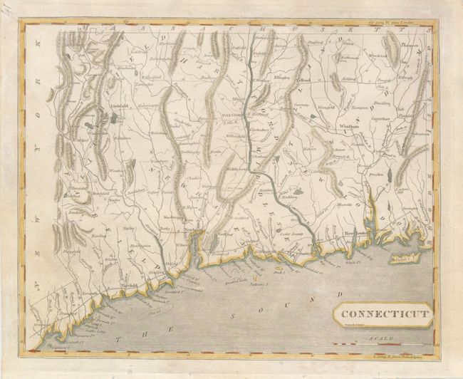
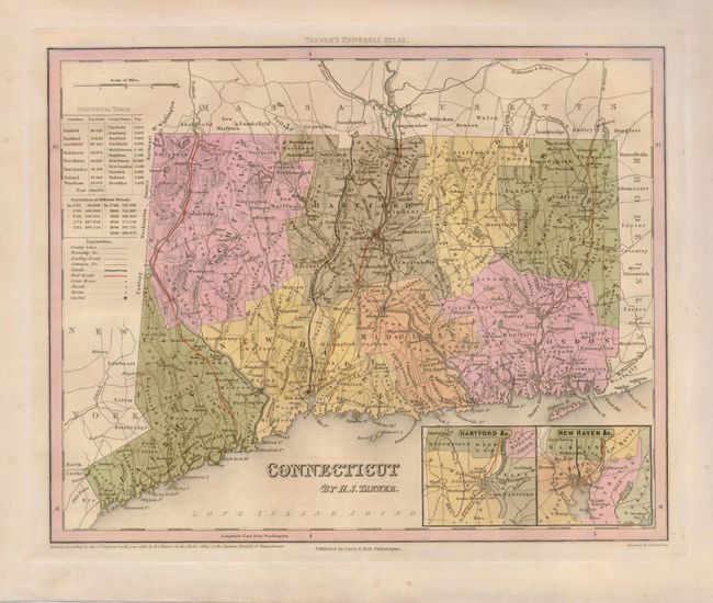
These two maps provide a nice comparison and view of the rapid development taking place in the early 19th century.
1) By Samuel Lewis, published in A New and Elegant General Atlas, 1804 (9.8 x 8"). The counties are delineated, but not townships. There are some roads shown with their distances between towns.
2) By Henry Schenck Tanner, published in A New Universal Atlas, dated 1839 and published circa 1842 (14 x 11.3"). This map includes insets of Hartford and New Haven and includes the township boundaries in additions to county boundaries. It clearly shows the network of new roads and canals including the Farmington Canal, and three railroads.
References: Thompson (CT) #49 & 90.
Condition: A