Subject: Colonial New England and Mid-Atlantic
Period: 1744 (circa)
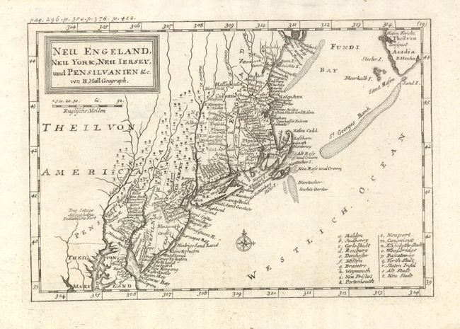
Publication: Das Britische Reich in America
Color: Black & White
Size:
10 x 7 inches
25.4 x 17.8 cm
This is the German edition of Herman Moll's earliest map of New England, originally appearing in John Oldmixon's "The British Empire in America" in 1708. The map shows great early colonial detail throughout with place names in a mixture of English and German. New York is confined to a narrow strip along the Hudson River and New Jersey is divided into East and West New Jersey. The coastal area from Casco Bay to Chesapeake Bay is full of detail with a multitude of place names. The Massachusetts and Plymouth colonies are noted, as well as the location of the Sasqahana Indian Fort. Small compass rose and engraved title block.
References: McCorkle #744-6.
Condition: A+
Very nice example with full margins and dark impression.