Subject: United States
Period: 1929 (published)
Publication:
Color: Printed Color
Size:
18.5 x 26 inches
47 x 66 cm
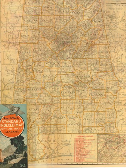
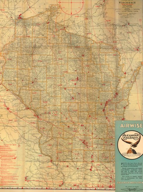
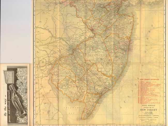
This lot is a great set of the rare "Air Trails" pocket maps. Each is complete with the original booklet that is filled with information for the aviator, a list of cities and towns, advertisements and more. Some aviation related sections include an Airport Directory, Aids to Navigation, and the Practical Air Navigation which reads much like a modern Private Pilot's lesson book with information on Plotting the Course, How To Find the Compass Course, Corrections for Wind, the Magnetic Compass and a Time and Distance Chart. Each also contains a double page Airway map of the United States that includes the routes of over forty airlines, air mail routes and more. The handsome Art Deco-style cover features a Ford Tri-Motor with a steam locomotive below.
This lot includes the following maps: Alabama, Arkansas, Connecticut, Georgia, Idaho, Louisiana, Maine, Mississippi, New Jersey, North Carolina, North Dakota, Oregon, Pennsylvania, South Carolina, Vermont, Virginia and Wisconsin. The dimensions given are approximate with some maps larger. Each map has a standard Rand McNally map on one side and the Air Trails map on the verso. The map uses red overprinting to note the elevation of high ground and mountains. The legend locates Public Airports, Restricted Airports (Army, Navy, Clubs, Private, etc.), Sea Plane Ports, Revolving Beacon Lights, and aids to navigation such as RS, RD, and RM radio stations. In many cases the maps document many early fields that no longer exist. These maps were produced for only a short time and are rare, more so in a large set.
According to the Air Fields Database (www.airfieldsdatabase.com/get/DIR/Directories.htm): "Other map makers also produced directories and maps. The best of these were produced by Rand McNally and they were called STANDARD INDEXED MAP WITH AIR TRAILS. They went for the princely sum of $0.50 - at that time a large amount of money. These are rare to find but they do turn up from time to time. The main printing (that I am aware of) seems to have been in 1929. I don't know if they produced one for each state (total would have been 48 at the time) or not. These often contained a lot of other data than just airways. Railroads, boats, highway and other things were incorporated. They were printed for possible carrying in a large pocket. These were 4.25 inches wide and 9.25 inches tall. The map was folded and glued to the back cover. Some of these that come on the market have the map torn out. I have only two - Illinois and Louisiana. They are rare and hard to find."
References:
Condition: A
All are very good or fine. The Idaho map is detached from the booklet with no damage.