Subject: World & Continents
Period: 1598 (published)
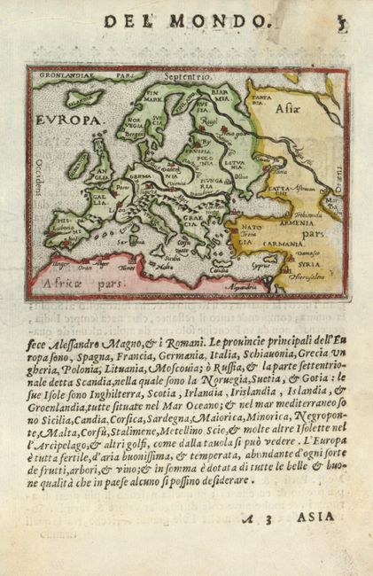
Publication: Il Theatro del Mondo
Color: Hand Color
Size:
4 x 3 inches
10.2 x 7.6 cm
This wonderful set of miniature maps come from the second pocket atlas based on Abraham Ortelius' folio Theatrum. It is often referred to as the plagiarized version of the Epitome. The copper plates are closely copied from those of Philip Galle's 1577 edition. The maps can be differentiated from the Galle plates by the distinctive Italian engraving style, which features stipple engraved seas, and in the first state, the Italian text below the maps. The maps are all on a full sheet (5.5 x 7.5") of Italian text.
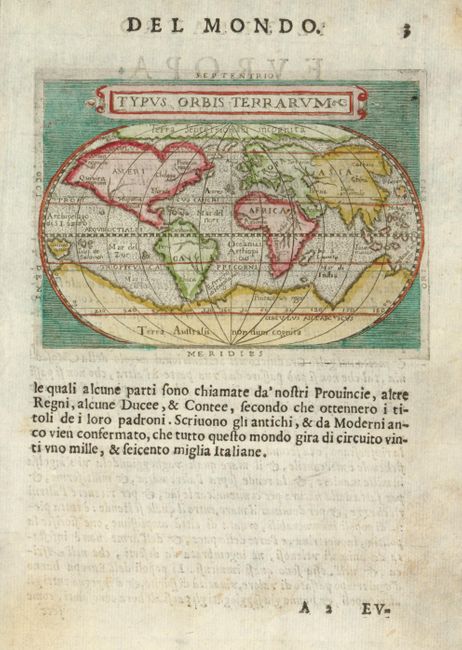
1) Typus Orbis Terrarum is based on Ortelius' famous oval map of the world. Huge polar continents providing balance for the world's continents and a Northwest Passage is prominently featured. Ref: Shirley #214.
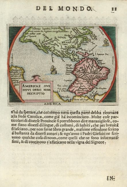
2) Americae Sive Novi Orbis Nova Descriptio is a reduced version of the folio version of 1570. The bulge in the southwestern coastline of South America is present - even though it had already been corrected in the folio version of this period. In North America, several mythical place names appear, including Norembega, Quivira, Tolonteac, Tigues, and Cevola (the 7 golden cities). Burden #126. >br>
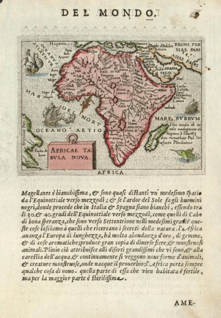
3) Africae Tabula Nova is a much simplified version of Ortelius' folio map with several geographic features omitted. The most important change being the lack of the smaller of the two Ptolemaic source lakes for the Nile, which apparently was derived from Joao de Barros' description of Central Africa. The map is adorned with quaint little ships and a sea monster. Betz #39.
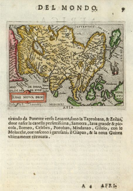
4) Asiae nova Desc is a reduced version of Ortelius' important map of Asia with its distinctive 'kite-shaped' Japan.
5) Europa is a charmingly simple map showing minimal detail that stresses the major rivers and mountain ranges.
References: King (2 ed.) pp. 78-79. See above for references on individual maps.
Condition: A
There are some minor stain in the blank margins.