Subject: North America
Period: 1730 (circa)
Publication:
Color: Hand Color
Size:
22.5 x 17.5 inches
57.2 x 44.5 cm
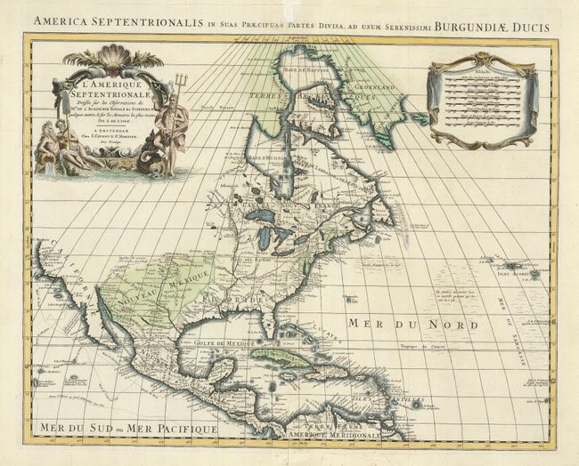
This is Pierre Mortier's re-engraved version of Delisle's foundation map of North America. It is nearly identical to the Delisle map, with California returned to its peninsular position rather than as an island. Cape Mendocin is the farthest northern point in California, and the north portion of the continent is left blank. The Great Lakes are well-defined, based on Coronelli, with French forts noted. The English settlements are confined east of the Alleghenies, and Spanish forts are clustered around Santa Fe. The Mississippi River valley is well developed with recent French settlements. The first mention of what would be called the Sargasso Sea is noted in the North Atlantic. The map is decorated with an aquatic-themed figural cartouche and a draped scale of miles.
References: Tooley (Amer) p.19, #33; cf Wheat [TMW] #79.
Condition: B+
The original color is slightly faded. The centerfold, with a short tear, has been reinforced with Japanese tissue and some tears in the bottom margin and border have been repaired.