Subject: Western Hemisphere
Period: 1785 (dated)
Publication: Atlas Geographique des Quartes Parties du Monde
Color: Hand Color
Size:
23.5 x 18.5 inches
59.7 x 47 cm
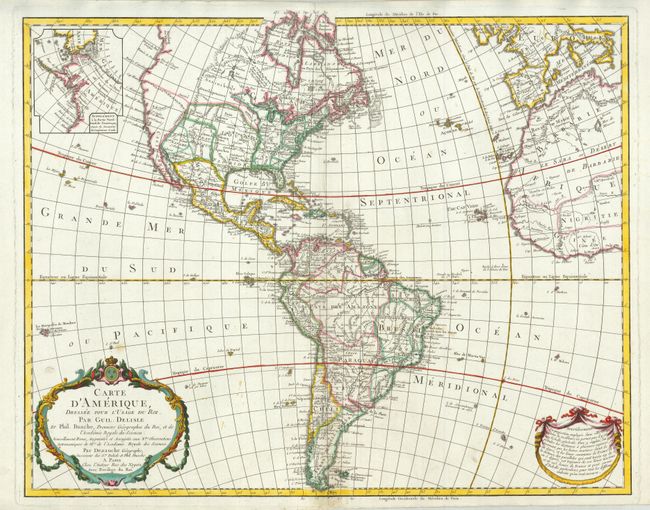
This is a later, updated edition of the important map that was first issued by Delisle in 1722. It was one of the most popular maps of the 18th Century. The new United States is noted extending to the Mississippi River, but the individual state boundaries are still shown on the Appalachian Mountains. Updates include the completion of the western coast above California and changes to the interior topography including a number of spurious mountains ranges in the west, going east to west and north to south, and sometimes doing both within the same range. This edition has an inset of Cook's explorations in the Pacific Northwest, but without the related key from the previous edition. The river systems in South America have been updated. The map was published in 1789, and still has the royal seal and crown on the top of the cartouche, which was removed after the establishment of the French Republic in 1792.
References: Tooley (Amer) p. 15, #10.
Condition: A
Bright impression and clean paper with finely applied hand color. There are a few spots in the ocean and a small area of paper damage in lower margin that has been expertly repaired.