Subject: South Pacific Ocean - Oceanie
Period: 1619 (circa)
Publication:
Color: Black & White
Size:
16 x 6.5 inches
40.6 x 16.5 cm
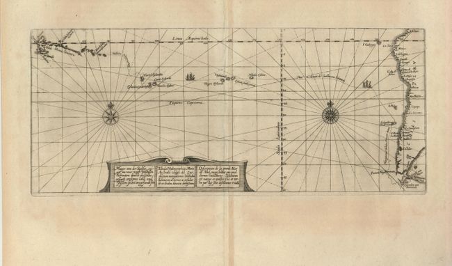
This early sea chart of the South Pacific exemplifies the vast emptiness of the huge ocean. The map is centered north/south on the Tropic of Capricorn and extends from a portion of New Guinea's coastline eastward to show the entire western coastline of South America. A few islands are shown in the Pacific including the Cocos. The chart presents a very early depiction of the Schouten/Le Maire voyage in the years 1615-17. This important exploration was the first to sail round Cape Horn, ending the long held theory that Tierra del Fuego was part of a great southern continent and defining the southern limits of the American continent. Fine rhumb lines, sailing ship and two very intricate compass roses embellish. At bottom a scroll cartouche describes the region and includes the title as part of the description.
References:
Condition: B+
Very nice impression on a full sheet with very wide margins at top and bottom. A little toning and creasing along centerfold with some old repairs. Large fleur-dy-lis watermark.