Catalog Archive
Auction 129, Lot 824

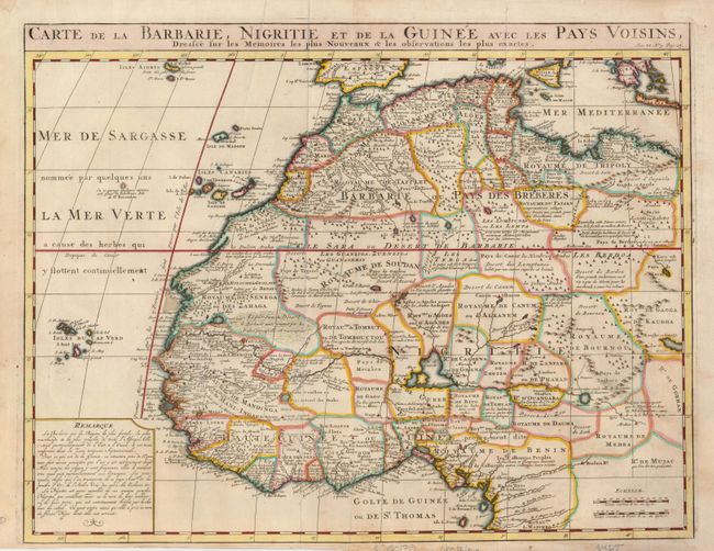
"Carte de la Barbarie, Nigritie et de la Guinee avec les Pays Voisins, Dressee sur les Memoires les Plus Nouveaux & les Observations les Plus Exactes", Chatelain, Henry Abraham
Subject: Western Africa

Period: 1710 (circa)

Publication:

Color: Hand Color

Size:
20.3 x 15.8 inches
51.6 x 40.1 cm
Download High Resolution Image
(or just click on image to launch the Zoom viewer)

This great map of western Africa is based on Guillaume Delisle's map. It covers from the Barbary coast to below the equator. There is a mass of geographic detail and notations in the interior with information on the rivers and lakes. Numerous tent encampments are depicted throughout the Sahara Desert.

References:

Condition: B+

There are a couple printer's creases and some light foxing, mostly on the verso. The paper edges have been trimmed and reinforced with archival tape.

Estimate: $230 - $300

Sold for: $170

Closed on 9/23/2009

Archived