Catalog Archive
Auction 129, Lot 630

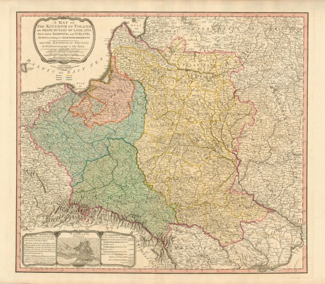
"A Map of the Kingdom of Poland and Grand Dutchy of Lithuania Including Samogitia and Curland…Prussia", Faden, William

Subject: Eastern Europe, Poland

Period: 1799 (dated)

Publication:

Color: Hand Color

Size:
23.5 x 21 inches
59.7 x 53.3 cm
Download High Resolution Image
(or just click on image to launch the Zoom viewer)

This fine map, which covers present-day Poland, Lithuania, Belarus and part of the Ukraine, shows Poland as divided between the Prussians, Austrians and Russians, from the First Dismemberment in 1772 to 1797, when Curland was annexed by the Russians. An inset containing a bird's-eye plan of Warsaw explains that Faden's source is the Rizzi-Zannoni 24-sheet map of 1772 that was commissioned by the King of Poland. There is also a table detailing the loss of a third of Poland's population in the First Dismemberment. Below the title cartouche is a color key that identifies Russian, Prussian and Imperial control.

References:

Condition: A+

Sharp impression and original color with wide original margins.

Estimate: $500 - $600

Sold for: $425

Closed on 9/23/2009

Archived