Subject: France and Germany
Period: 1750 (circa)
Publication:
Color: Hand Color
Size:
14.8 x 43.3 inches
37.6 x 110 cm
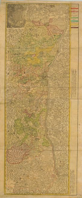
This map of Alsace covers the course of the Rhine from Rheinzabern to Basel. The map was based in part on the important 1576 map by Strasbourg architect, engineer and mapmaker Daniel Speckle. The map is very detailed and in full original color with a bold color key in the upper right margin. The title cartouche features the winemaking industry with a scene of putti and satyrs imbibing in their product. This is an early edition, probably separately issued from Homann's studio, and without the normal publisher's imprint and address.
References:
Condition: C
The map was issued folded and there are some extraneous folds as well. It is toned overall with some stains and flyspecks, mostly in the blank margins. The verso of the margins are reinforced with old paper, repairing some short tears. Still attractive and deserving of some minor cleaning and repair.


