Catalog Archive
Auction 129, Lot 460

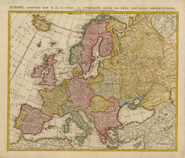
"Europe, Composee par G. de l'Isle, et Corriggee Selon le plus Nouvelle Observations", Elwe, Jan Barend
Subject: Europe

Period: 1792 (dated)

Publication: Atlas Geographique et Universel

Color: Hand Color

Size:
23.3 x 19 inches
59.2 x 48.3 cm
Download High Resolution Image
(or just click on image to launch the Zoom viewer)

An expansive map of Europe, extending from Iceland to the Caspian Sea, based on the cartography of Guillaume Delisle. The map is filled with finely engraved detail of countries, cities and topography. The prime meridian is shown bisecting Iceland, fixed at the Isle de Fer per Louis the XIII.

References:

Condition: A

Crisp impression and original color. There is a minor fold repair in bottom margins, else fine.

Estimate: $475 - $550

Unsold

Closed on 9/23/2009

Archived