Subject: Tobago
Period: 1779 (dated)
Publication: Atlas Ameriquan Septentrional
Color: Hand Color
Size:
23.8 x 18.8 inches
60.5 x 47.8 cm
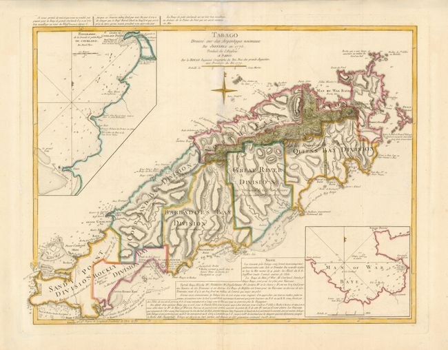
This is a very scarce map of the island of Tobago vividly portraying the mountainous terrain and numerous protective bays. The chart is a French issue of Thomas Jefferys' map of 1775. The map illustrates the rapid development of sugar plantations; each large division is noted with the number of estates (286 total) and acreages. Only a small, mountainous portion of the island is undeveloped. The map depicts the Indian villages, watering places, forts (including a demolished French fort), rocks, shoals, and anchorages with very specific navigational notations. Two large insets depict Great & Little Courland Bays and Man of War Bay.
References:
Condition: A+
Minor printer's crease at bottom still fine.