Catalog Archive
Auction 129, Lot 387

"Carta Esferica de una Parte de la Costa Setentrional y Meridional de la Isla de Cuba desde Punta Icacos y Cayo de Piedras hasta el Cabo San Antonio, con la Isla de Pinos y Cayos Adyacentea…", Direccion de Hidrografia
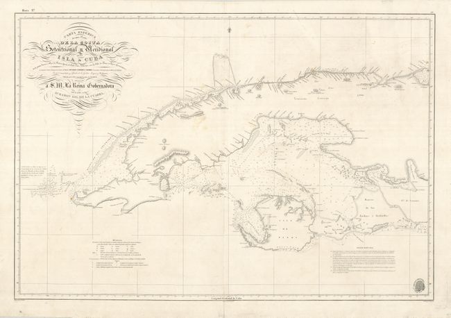
Subject: Cuba

Period: 1854 (dated)

Publication:

Color: Black & White

Size:
34.5 x 23.5 inches
87.6 x 59.7 cm
Download High Resolution Image
(or just click on image to launch the Zoom viewer)

This clear and detailed Spanish map of the western part of Cuba includes coastal features, soundings, navigational hazards, currents, coastal islands, lighthouses and settlements, including Havana. The chart was originally drawn in 1837 and has been updated to 1854 with this edition. Spanish sea charts are rare on the market.

References:

Condition: B+

Generally very clean and good condition for a sea chart, with a few faint spots. There are a few short tears in the blank margins and the centerfold has been professionally reinforced with Japanese tissue.

Estimate: $425 - $500

Sold for: $300

Closed on 9/23/2009

Archived