Catalog Archive
Auction 129, Lot 386

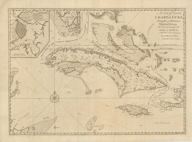
"A New & Correct Chart of Cuba, Streights of Bahama, Windward Passage, the Current through the Gulf of Florida, with the Soundings, &c.", Mount & Page

Subject: Cuba and Bahamas

Period: 1763 (circa)

Publication: The English Pilot

Color: Black & White

Size:
25.8 x 18.5 inches
65.5 x 47 cm
Download High Resolution Image
(or just click on image to launch the Zoom viewer)

This scarce, large-scale chart is centered on Cuba and covers the region between the southern part of Florida and Jamaica. The tip of Florida is shown as a mass of islands with the route of the Galleons Home skirting the shorelines. The Bahamas are well delineated with many of the major islands identified. The map is primarily concerned with the coastal details of the region, including soundings, shoals, bays, anchorages, shipping lanes, currents, etc. A large inset of Havana Harbor is included. Printed on two joined sheets, as issued.

References: Cueto #42.

Condition: B+

Nice impression. Issued folded, now flattened. A 2" tear at lower right has been professionally repaired.

Estimate: $1,200 - $1,500

Sold for: $700

Closed on 9/23/2009

Archived