Catalog Archive
Auction 129, Lot 377
"Le Golfe de Mexique, et les Provinces et Isles qui l'Environe comme sont la Floride au Nord, le Mexique ou Nouvelle Espagne a l'Ouest, la Terre-Ferme au Sud, les Is. Antilles, Lucayes, St. Domingue et Jamaique a l'Est…", Fer, Nicolas de
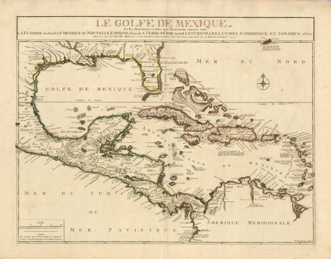
Subject: Gulf of Mexico and Caribbean
Period: 1717 (dated)
Publication:
Color: Hand Color
Size:
23.8 x 18 inches
60.5 x 45.7 cm
Download High Resolution Image
(or just click on image to launch the Zoom viewer)
(or just click on image to launch the Zoom viewer)