Subject: Southwestern United States, Texas, Mexico & Central America
Period: 1845 (circa)
Publication: New Universal Atlas
Color: Hand Color
Size:
14.7 x 11.7 inches
37.3 x 29.7 cm
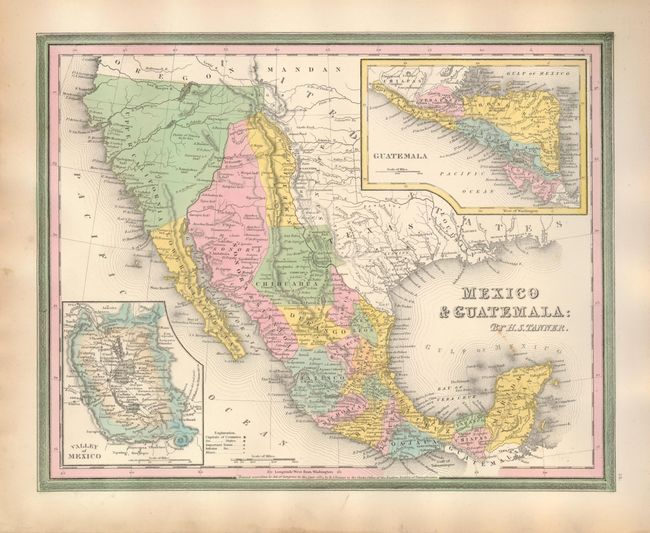
This map features a Texas configuration that fits between the republic period and early statehood. The large panhandle's northern boundary is the Arkansas River and it is labeled Santa Fe. New Mexico is confined west of the Rio Grande River. Sonora extends north into present-day Colorado and is wedged between New Mexico and Upper California. The rivers Timpanogos and San Buenaventura run straight through the Great Basin into the Pacific. The map presents a great picture of the region on the eve of the Mexican-American War. The colorful design is filled with detail of Indian Tribes and much more. This map is believed to be from the rare Carey & Hart edition based on the border with outer green and inner pink. Dated 1834 but published circa 1845. An important and interesting map.
References:
Condition: A
Map images is fine: bright impression and beautiful original color on a thick sheet with full margins. A little toning or soiling along left margin edge, otherwise fine.