Subject: Oregon
Period: 1910 (dated)
Publication:
Color: Printed Color
Size:
29 x 23 inches
73.7 x 58.4 cm
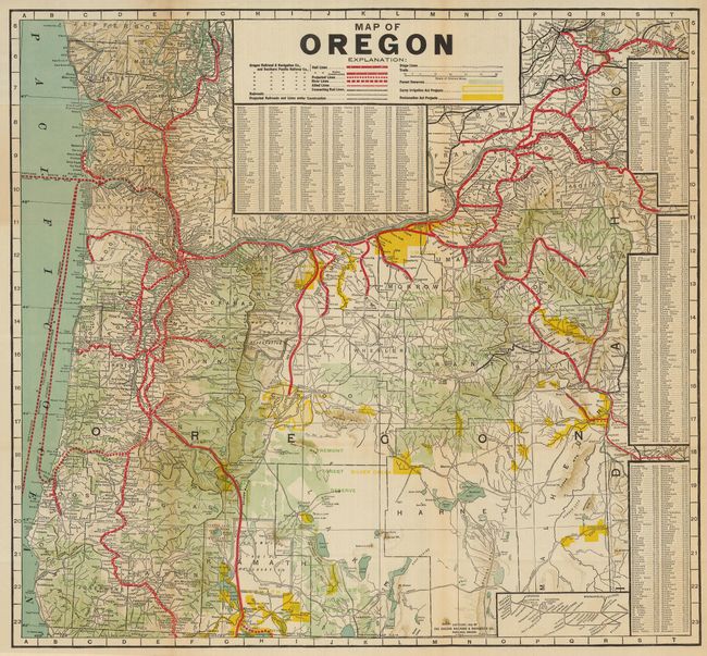
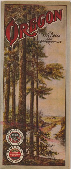
This terrific promotional map was published by the Southern Pacific Railway and the Oregon Railroad & Navigation Company. It was designed to attract settlers to Oregon, the "Land of Promise." The map details the routes of railroads throughout the state, with part of Washington to include Seattle and Spokane. Legend shows, through color and symbol, the railroad network, Forest Reserves, Reclamation Act Projects, and the Carey Irrigation Act projects. Several large tables key all towns mentioned on the map. At lower right is a small inset diagram of the railway network extending to Chicago. On the verso are 17 panels of marketing text describing the state to the potential immigrant, includes sections on timber, mineral wealth, and much more. The section Irrigation and Water Power describes the Deschutes, Umitilla, and Klamath Projects. Self folds, the cover features a colored image of the forest with farm lands and railroad in the background. An uncommon issue.
References:
Condition: B+
Fine color and impression. The map has a few fold intersection splits and there are a few short marginal fold splits at edge.