Subject: Montana
Period: 1876 (dated)
Publication: Department of Interior
Color: Black & White
Size:
31.5 x 22.3 inches
80 x 56.6 cm
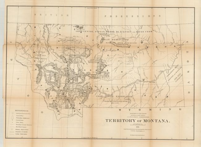
This large map details the extent of public surveys in Montana at this important time in its territorial history. It was produced prior to the Custer disaster so that information is not presented. The map shows four large Indian reservations noting the date and the law establishing them. It locates many forts; Tullock, Sarpy, Union, Buford, Peck, Galpin, and many more including the old forts of Alexander and Charles. The Crow Indian Agency, Milk River Agency, Baker's Post are shown. The Northern Pacific Railroad and its Forty Mile Limit are delineated. At this time surveying is mostly limited to the west-central portion with the eastern half devoid of any activity. The legend identifies land offices, Surveyor Generals Office, county seats, towns, villages, railroad limits, military reservations, and Indian reservations. Drawn on a scale of 1 inch to 20 miles. Montana was admitted into the Union in 1889.
References:
Condition: B+
Folding as issued. Full margins with light toning along some folds and a few fold intersections with splits.


