Subject: Hawaii
Period: 1912 (dated)
Publication:
Color: Printed Color
Size:
38.8 x 29.8 inches
98.6 x 75.7 cm
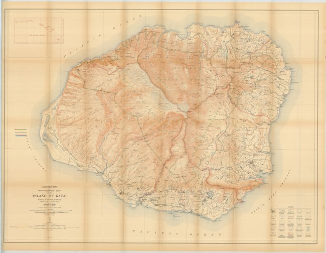
The precisely engraved and highly detailed 1912 edition of this map from the 1910 surveys. It is lithographed in four colors and drawn on a scale of one inch per mile with 50 foot contour intervals. Remarkable detail of roads, trails, railroads, coastal detail including lighthouses, topography, watershed and even individual buildings. It locates several Forest Reserves including the Lihue-Koloa, Halele and Moloaa reserves. Legend at lower right identifies 25 different physical features. Inset at upper left illustrates "The Hawaiian Islands." The map was prepared by the Geological Survey with the cooperation of W.F. Frear, Governor and Marston Campbell, Supt. of Public Works.
References:
Condition: B+
Folding as issued, with fine color. Faint hint of toning on some folds, one edge fold with split supported on verso with archival tape.