Catalog Archive
Auction 129, Lot 266

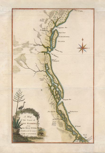
"A Map of the Coast of East Florida, from the River St. John, Southward to near Cape Canaveral", Anon.

Subject: Florida

Period: 1800 (circa)

Publication:

Color: Hand Color

Size:
6 x 9.5 inches
15.2 x 24.1 cm
Download High Resolution Image
(or just click on image to launch the Zoom viewer)

This scarce map of the coast of northeastern Florida was copied from the map drawn by David Taitt for William Bartram's Travels through North & South Carolina, Georgia, East & West Florida [1791]. The map was based on the survey of East and West Florida by Bernard Romans and George Gauld in 1771-1772. It is one of the few detailed maps of this region that was published in the early Spanish Period. It shows swamps, locations of rivers, islands, and two shipwrecks. The cartouche is slightly different than the Bartram map with a crane, deer, and wild boar.

References:

Condition: B

Remargined at both top and bottom with slight facsimile of the neatlines.

Estimate: $400 - $500

Sold for: $550

Closed on 9/23/2009

Archived