Catalog Archive
Auction 129, Lot 258

"[Lot of 3] Map of Washington and Georgetown", U.S. Government

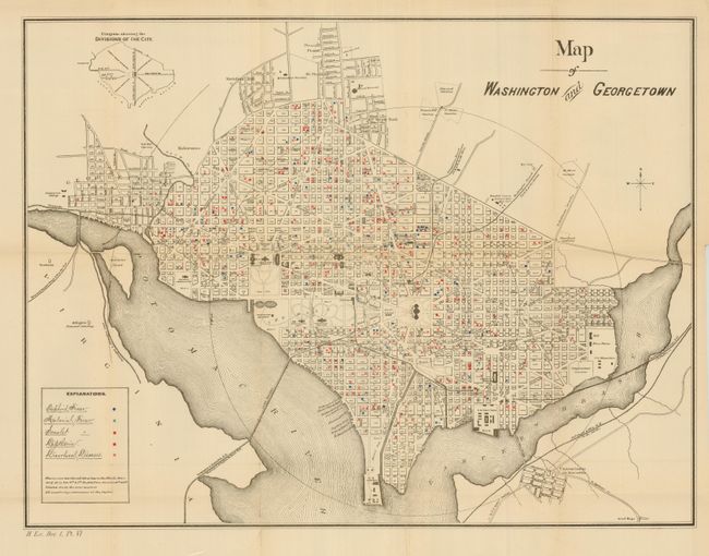
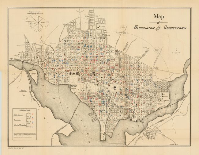
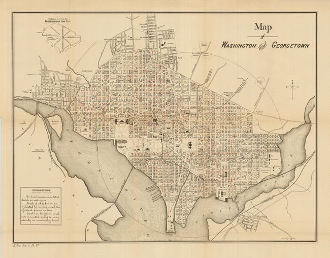
Subject: District of Columbia

Period: 1880 (published)

Publication: Report of the Health Officer of the District of Columbia

Color: Printed Color

Size:
21.3 x 16 inches
54.1 x 40.6 cm
Download High Resolution Image
(or just click on image to launch the Zoom viewer)

This is a historical set of thematic maps focused on health issues in the nation's capital. Each map has colored numbers indicating deaths and communicable diseases on each block. Two maps separately code white persons and black persons. The first map shows deaths by Typhoid Fever, Malarial Fever, Scarlet Fever, Diphtheria and Diarrheal Diseases. The next focuses on deaths from lung afflictions. The last map gives the combined total of deaths in each block. All are marked "H. Ex. Doc. 1, Pt. IV" at lower left.

References:

Condition: A

Folding, as issued, on thick paper. All have full margins and fine color. A hint of toning along one fold.

Estimate: $150 - $200

Sold for: $160

Closed on 9/23/2009

Archived