Subject: Colorado
Period: 1914 (dated)
Publication:
Color: Printed Color
Size:
22.5 x 17 inches
57.2 x 43.2 cm
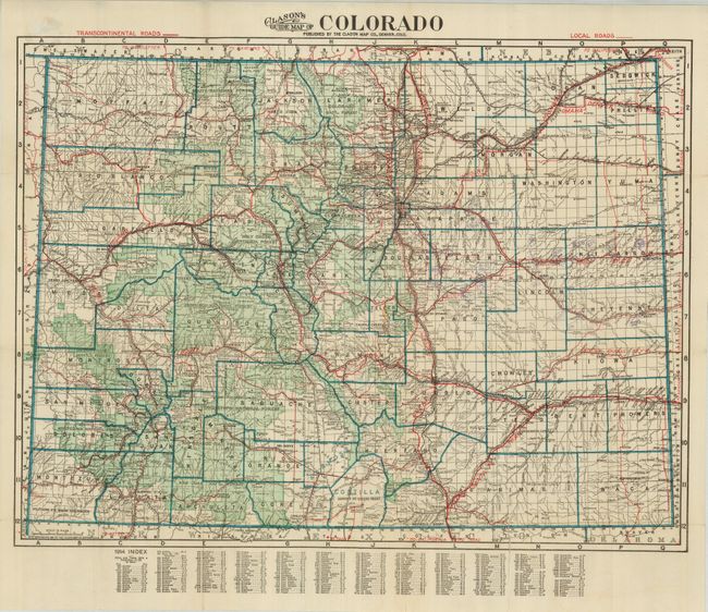
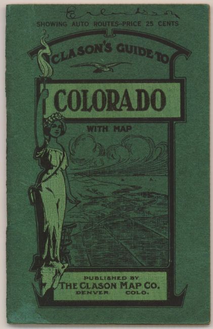
Nice, early guide map that emphasizes the auto routes. The Transcontenintal Roads are shown in bold red lines along with the name of the highway and the Local Roads are depicted with a thin red line. The map predates the US Highway System, which was created in 1925 as a response to confusion created by similarly named highways throughout the United States. One of the most popular names was the Lincoln Highway, which is represented twice on this map; the Great North and South Lincoln Highway following the course of present-day I-25 and another Lincoln Highway linking Denver with Omaha. The other major roads shown are the Midland Trail and the Golden Belt Route following the course of present-day Interstate 70, and the old Santa Fe Trail. The map folds into pictorial, paper covers titled "Clason's Guide to Colorado with Map" with a 40-page index (4 x 6.3").
The Clason Map Company was a pioneer in the production of maps to meet the growing demand from automobile enthusiasts. The existing bicycle and railroad maps did not serve well for this new form of transportation and maps were needed to identify roads suitable for automobiles; roads with adequate gravel, bridges, gasoline and repair shops. The American Automobile Association produced the first maps specifically for automobiles in 1905 and George S. Clason quickly followed suit compiling maps with the assistance of local automobile clubs.
References:
Condition: B
Two clean fold separations, just entering the map and a couple minor of splits at fold intersections. Overall clean with very good covers. The map is separated from the cover. There are some light pencil marks on the roads east of Denver.