Subject: California
Period: 1867 (dated)
Publication: New General Atlas
Color: Hand Color
Size:
10.8 x 13.5 inches
27.4 x 34.3 cm
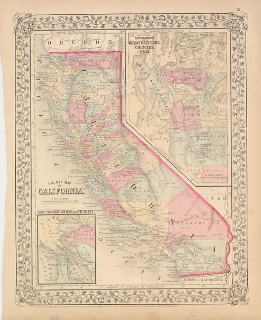
This map is colored by county and provides a good view of the developing railroads, both completed and proposed. The Wagon Road to Gt. Salt Lake takes off out of San Bernardino County roughly along the same path as present-day Interstate 15. Utah is on the eastern boundary of California and the settlements of the Great Salt Lake form a large inset map taking in the region of present-day Nevada. The huge San Bernardino County extends from Utah Territory nearly to the Pacific Ocean at Los Angeles County. A smaller inset shows the vicinity of San Francisco Bay. This lovely stone engraved map is enclosed in Mitchell's second edition grapevine borders.
References:
Condition: A
There is some minor soil in the blank margins with some edge tears that have been closed with archival tape.