Catalog Archive
Auction 129, Lot 239

"Map Showing the Atchison, Topeka and Santa Fe Railroad System with its Connections", Colton, G.W. & C.B.

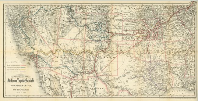
Subject: Southwestern United States

Period: 1889 (dated)

Publication:

Color: Printed Color

Size:
32 x 16 inches
81.3 x 40.6 cm
Download High Resolution Image
(or just click on image to launch the Zoom viewer)

This railroad map provides excellent detail of the area south of the 43rd parallel from the Pacific Ocean to the Mississippi River. The map delineates the major rail lines, shown via colorful overprinting, including numerous branch lines. It also shows good watershed and topographical information. Each state and territory is outlined in light red. Blank verso. This great railroad map was produced by the Colton brothers for the 1888 annual report by the Atchison, Topeka and Santa Fe Railroad.

References:

Condition: A

Beautiful, fine example with just a few fold intersection splits invisibly closed on verso with archival tape. Folding as issued.

Estimate: $200 - $250

Sold for: $150

Closed on 9/23/2009

Archived