Catalog Archive
Auction 129, Lot 195

"[Lot of 2] A Map of Part of Rhode Island, Shewing the Position of the American & British Armies at the Siege of Newport… [and] Pays Situe entre Frog's Point et Croton River…", Marshall, John

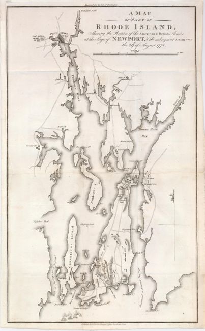
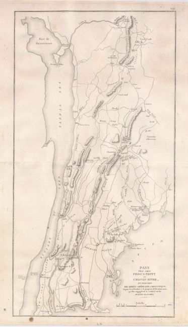
Subject: Rhode Island & New York

Period: 1806 (circa)

Publication: Marshall's Life of Washington

Color: Black & White

Size:
10 x 16.7 inches
25.4 x 42.4 cm
Download High Resolution Image
(or just click on image to launch the Zoom viewer)

Pair of copper engraved Revolutionary War plans; first from an English edition and second from a French edition of this popular history book. Both maps provide a wealth of information on towns and villages, roads, colleges, mills and much more. First shows Providence and Newport with the British fleet offshore and the various military positions in August of 1778. Second shows the positions of the British and American armies in the area northeast of New York City along the Hudson River between October 12 and 28, 1776.

References:

Condition: B+

Both printed on sturdy paper. First was issued folded with the binding trim extended to better accommodate framing. There is a tiny hole near the center of the map. Second with a few minor spots in the margins.

Estimate: $180 - $230

Sold for: $110

Closed on 9/23/2009

Archived