Subject: United States
Period: 1862-1898 (circa)
Publication:
Color:
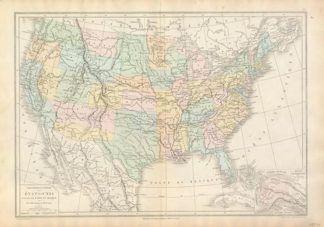
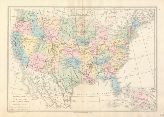
The first two maps are editions of the same French map that illustrate the territorial development of the western United States, as well as the often times erroneous information found on maps of this period. The earlier edition shows Washington Territory with its western boundary on the Rocky Mountains, Nevada encroaching into California and an oversized Utah. Arizona is shown below New Mexico as General Baylor's Confederate Territory. Idaho and Wyoming are colored the same, but named separately with Idaho not extending to the border with Canada. The later edition is fairly accurate, except that Nevada is now too large, at Utah's expense, Wyoming encroaches slightly into Idaho and Montana and Dakota is one territory. The pair make an interesting comparison. Published by Drioux & Leroy, Paris, hand color, circa 1862 & 1866 17" x 11". The first has faint toning along centerfold (B+), the later is fine (A+).
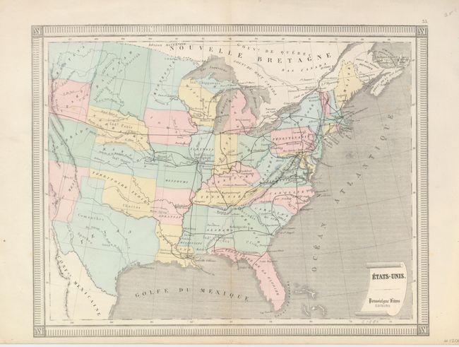
The third map, circa 1870, extends to include all of Texas. The Dakota's are one territory and Wyoming is here called Idaho. Railways are shown with a dark black line. Title in a scroll at lower right. Paris, hand colored, 13.5" x 10.5. Surrounded with keyboard-style border. Very slight toning along lower portion of centerfold (A).
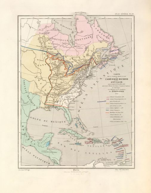
The fourth map gives historical geography of the eastern United States into the west as determined by the Treaty of Paris, signed in Versailles on 1783. The colonial holdings of eight countries are delineated in line and color. Extends to include the Yucatan Peninsula, Guatemala and the islands of the Caribbean. Drawn by Charles Perigot and published in Paris by Charles Delagrave in 1865. Hand color, 9" x 11.5". Fine (A+).
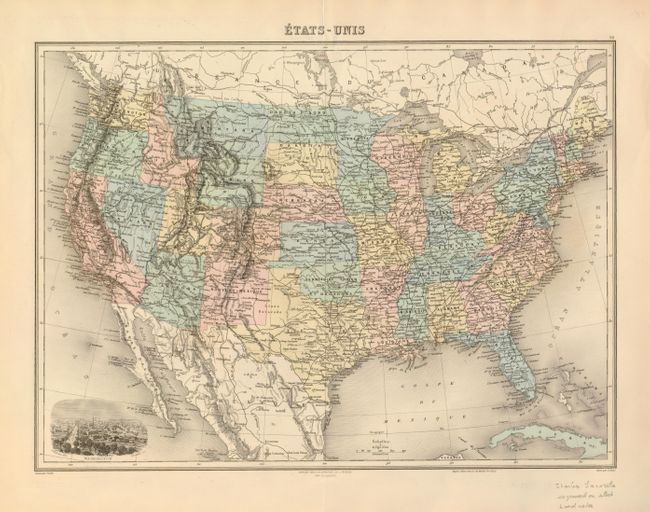
The final map was published from Paris circa 1898. A remarkably detailed and finely engraved map that includes a vignette birds-eye view of Washington at lower left. The view shows individual buildings. North and South Dakota are named, Indian Territory is here Territoire et Oklahoma. Printed color, 16.5" x 11.5". Fine (A+).
References:
Condition:
See individual descriptions.