Subject: Eastern North America and West Indies
Period: 1806 (dated)
Publication:
Color: Hand Color
Size:
16.5 x 12.5 inches
41.9 x 31.8 cm
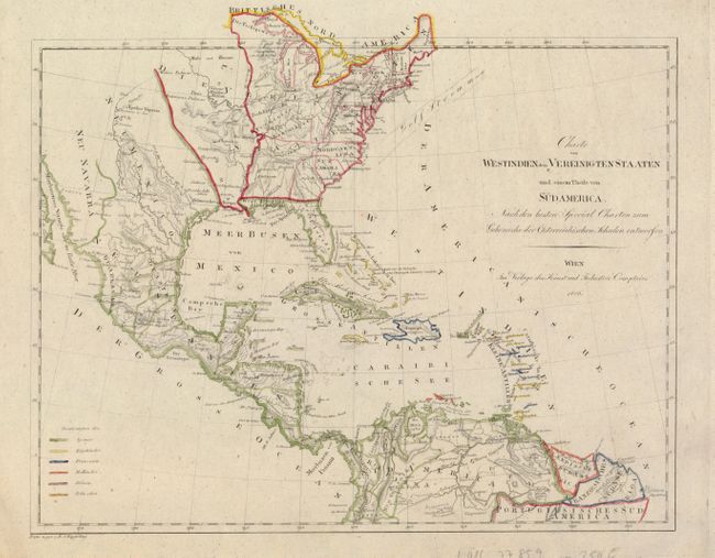
This scarce Austrian map depicts the United States after the Louisiana Purchase. The newly acquired region includes Fort Natchitoches, Fort St. Louis, and the Grosse Meadows Nation. One of the most interesting features on the map is the region labeled Tennessee et Kentucket, with Tennessee above Kentucky on the western side of the Ohio River! The map also has spurious topography with an elaborate east-west mountain range stretching across the plains. The Gulf Stream is noted in the Atlantic. A color-key distinguishes the colonial possessions in the West Indies and the portion of northern South America that appears on the map.
References:
Condition: A
Original outline color. There are some pencil notations in the blank margins.