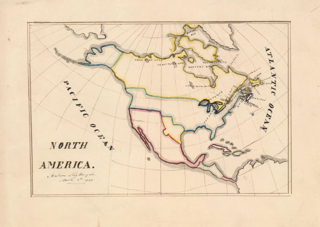
Subject: North America, Texas
Period: 1850 (dated)
Publication:
Color: Hand Color
Size:
9.5 x 6 inches
24.1 x 15.2 cm
This is a delightful manuscript map showing the political divisions in North America circa 1840, rather than the date on the map of 1850. Texas is shown as an independent republic. The United States includes its claims into British Columbia. The only place names appear in Canada, indicating Canadian origins. Signed by Arthur Nightingale, March 2, 1850. Preparation of manuscript maps was a typical early 19th century classroom exercise. These classroom maps are found in several public map collections. But they are quite rare due to their ephemeral nature.
References:
Condition: A