Subject: North America
Period: 1806 (dated)
Publication:
Color: Hand Color
Size:
20.3 x 18.1 inches
51.6 x 46 cm
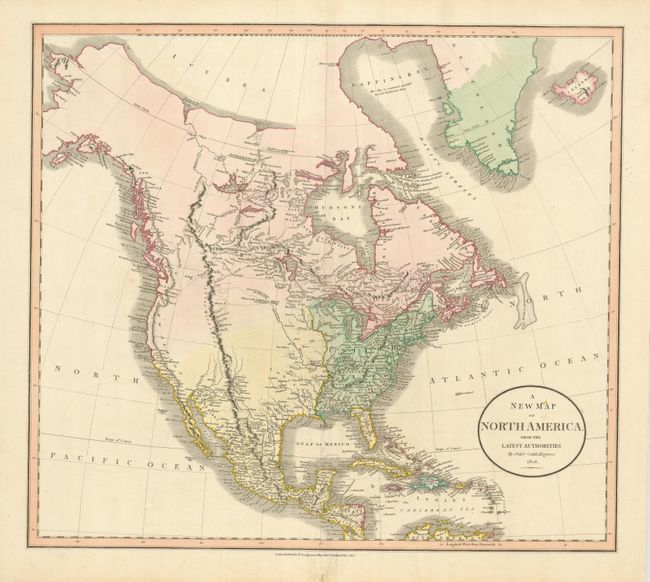
This great map describes the limited knowledge of the American West just prior to the publication of the findings from the expedition of Lewis & Clark. The United States is confined to the region east of the Mississippi River excluding eastern Florida. The west is shown mostly empty with ill-defined political boundaries, and the Rockies named the Stony Mountains. Western Canada is well developed from information gleaned from fur-traders and the Mackenzie expedition. The course of the Missouri River ends at the Pawnee village near "Villages of the tall Indians and Mandans." This is certainly one of the more interesting pre-Lewis & Clark maps, guessing at the supposed course of the Missouri above the Mandan Villages. There is remarkable detail along the coast of Alaska and British Columbia with the Icy Sea to the north in today's Beaufort Sea.
References:
Condition: A
Spectacular example that would be graded fine except for the expert repair to a small section in lower margin at centerfold.