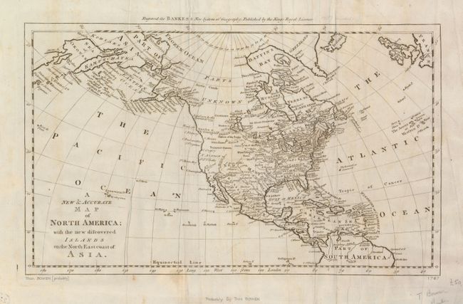
Subject: North America
Period: 1787 (circa)
Publication: Bankes's New System of Geography
Color: Black & White
Size:
17 x 10.3 inches
43.2 x 26.2 cm
The discoveries of Captain Cook are the focus of this map of North America. Alaska is fairly well formed although much of the Aleutian Island chain is depicted as a peninsula. The northeast coast of Asia with a well formed Kamtschatka Peninsula is also depicted. On the continent, the political divisions are delineated by dotted lines and numerous Indian nations are located. The interior of Canada is still marked as Parts Unknown. Although there is no engraver's signature, Thomas Bowen is known to have prepared the maps for Bankes's New System of Geography.
References:
Condition: B
Issued folding, now flattened with some creasing and a few spots of foxing. Pencil notations in the blank margins and remnants of paper mounting hinges on verso. There is a tissue repair on a fold intersection.