Subject: North America
Period: 1770-1850 (circa)
Publication:
Color:
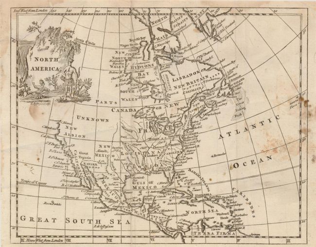
1) North America, Thomas Jefferys, c. 1770, (9 x 7"). This b&w map includes a curious representation of the Mississippi River, a triangular Florida with a north-south mountain range, and a fairly accurate delineation of the Great Lakes. The West is Parts Unknown and New Albion. The California coast is blank above C. Blanco, and the Great Fishing Bank is shown in the Atlantic. Native Americans grace the scenic title cartouche with a waterfall in the background. Some spots or stains in the Atlantic and a little below cartouche (B).
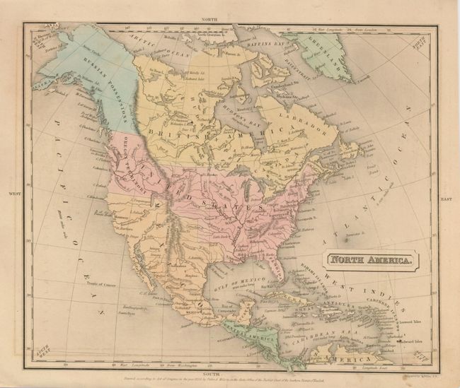
2) North America, Engraved by S. Stiles, published by Potter & Wilson, 1838, (10 x 8.5"). Fully hand colored, the map shows the U.S. claims in Oregon Territory to 54° N., which form a boundary with the Russian Possessions that include present-day Alaska. The Great Basin is fully mapped with numerous spurious features. (B+)
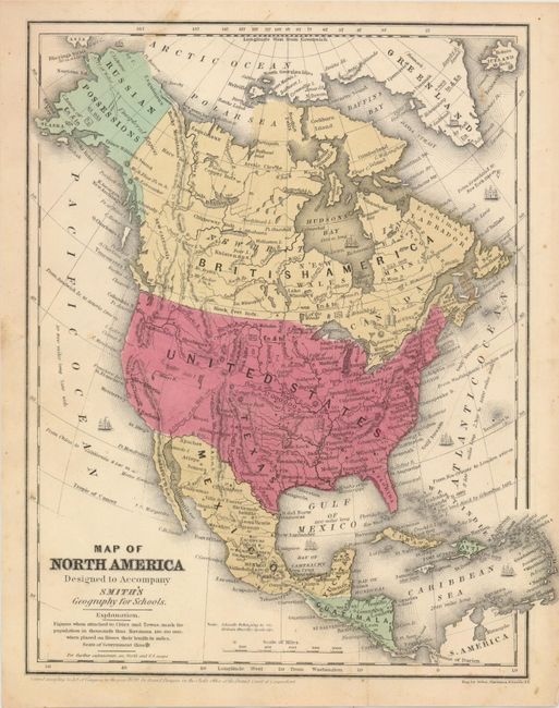
3) Map of North America to Accompany Smith's Geography for Schools., Daniel Burgess, 1839, [c.1850], hand colored, (8.3 x 10.8"). This map shows the United States with a population of 17 million people. The map of the continent shows the results of the Mexican-American War with the United States stretching fully from the Atlantic to the Pacific. The new state of Texas is depicted with the stovepipe panhandle extending to the 42nd parallel. The entire western region is mostly unsettled with only a few place names, some spurious rivers, and the Great Salt Lake too far to the east. Alaska is a large blank area labeled Russian Possessions with the notation Unexplored Region. (B+)
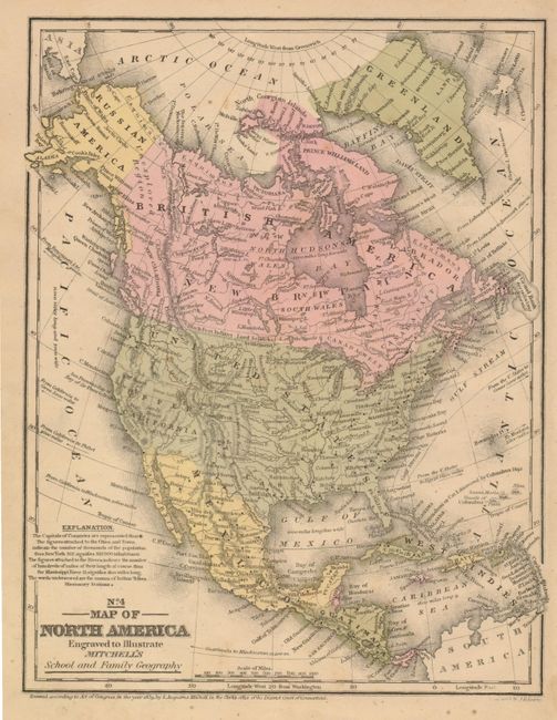
4) No. 4 Map of North America Engraved to Illustrate Mitchell's School and Family Geography, S. A. Mitchell, 1839 [c. 1850], hand colored, (8 x 10.3"). The map of the continent shows the results of the Mexican-American War with the United States stretching fully from the Atlantic to the Pacific. The new state of Texas is depicted with the stovepipe panhandle extending into present-day Colorado. Alaska is Russian America with the Aleutian Peninsula labeled Alaska. Canada is labeled both as British America and New Britain. There are numerous Indian tribes, major towns, good detail of major rivers, and a vague idea of the Rocky Mountains. The Great Basin is here called the Sandy Desert. (B+)
References:
Condition:
See individual descriptions.