Subject: Exploration and Surveys
Period: 1747 (dated)
Publication:
Color: Black & White
Size:
4 x 6.8 inches
10.2 x 17.3 cm
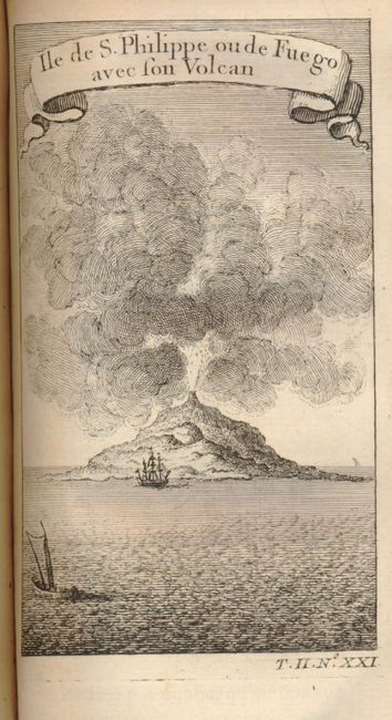
This is volume 7 from the first edition published by Didot in 1747. This volume describes the Cape Verde Islands and Western Africa. Title page printed in red and black, 500 pp, 13 engraved folding maps and full-page plates. Contemporary mottled calf, spine with raised bands and gilt, morocco labels. With full-page engraved views including "Ile de S. Philippe ou de Fuego avec son Volcan," a dramatic view of the volcano erupting with ships in the foreground.
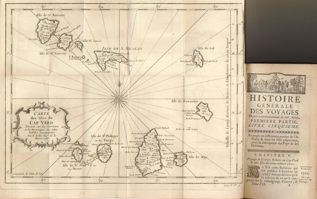
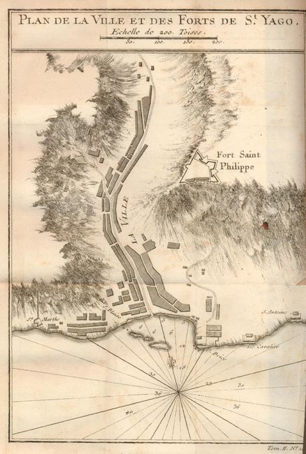
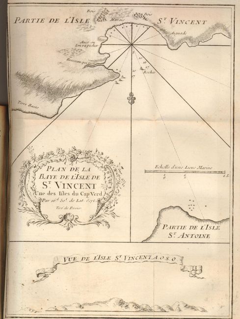
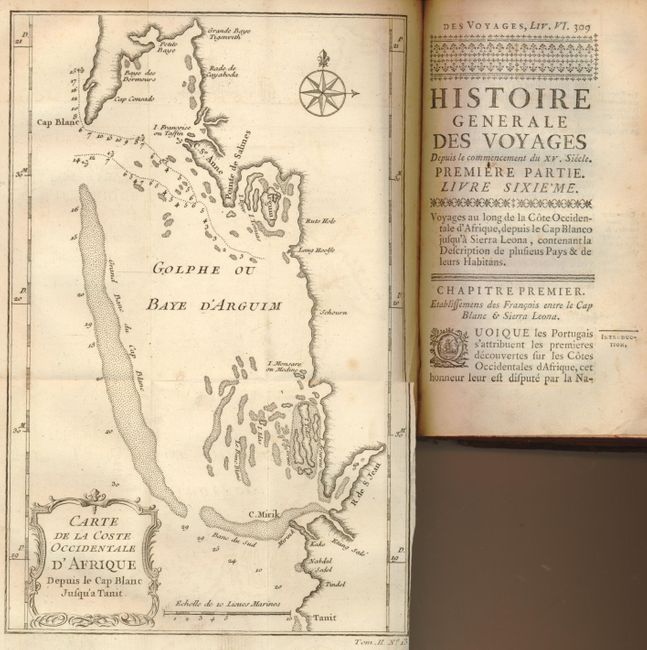
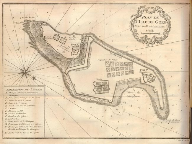
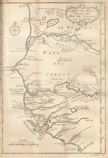
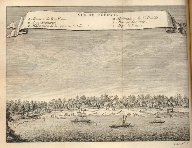
Contains the following folding maps: 1) Carte des isles du Cap Verd, (11 x 8.5"). Decorative cartouche and a rather wild compass rose with radiating rhumblines. Short tear at binding trim (B+). 2) Le Havre de Praya dans l'Isle de St. Jago/Veue de l'Ilsle S. Jago ou St. Jacques/Isle de May, (8.2 x 5.6"). Three maps on one sheet (A). 3) Plan de la Ville et des Forts de St. Yago, (6 x 8.2"). Details the area around Fort Saint Philippe. Tear at binding trim. (B) 4) Plan de la Baye de l'Isle St. Vincent, (6 x 8"). Rococo-style title cartouche and view below shows the island from the sea. (A) 5) Carte de la Coste Occidentale d'Afrique, (6 x 8"). Shows the bay and coast in Mauritania, western Africa. (B+) 6) Plan de la Baye et Isle d'Arguim, (8 x 6"). Another chart of the bay, this time a wider view that extends from Cape Saint Anne in the north to Pointe aux Tortues. Small hole in blank area of cartouche (C+). 7) Carte d'une Partie de la Coste d'Afrique, (6 x 8 "). Shows the mouth of the Senegal River, and Lac du Panier Foule. Extends from Tanit, past Portendie and south as far as Biyurt. (A) 8) Plan du Fort d'Arguim, (6 x 8"), (B+). 9) Plan de Portendic Appelle aussi Portudaddi ou Penia, (6 x 8"). Large compass rose and rhumblines. (A) 10) Plan de l'Isle de Gore avec ses Fortifications, (11x 7.7"). Terrific plan of the massively fortified citadel that covers the entire isalnd. (A) 11) Plan de l'Isle de Goree, sur les desseins du Sr. Compagnon, (14 x 7.7"). This is a fabulous birds-eye-view of the fortifications showing both forts (St. Michel and Fort St. Francois) and their surrounding ramparts. Table along the bottom keys 42 feartures to the map. Short binding trim tear (B+). 12) Carte des Pays Voisins des Riv. De Sanaga et Gambra, (6 x 8"). In Cameroon the map shows Cape Verga, the Kachao, Gambra and Sanaga Rivers, Cape Verde and extends north to Cape Miri. Shows the Lac de Gayor. (A) and 13) Vue de Rufisco, (7 x 6"). The village is will shown with three sailboats in the small bay. (A)
References:
Condition: B+
Contents generally sound and clean. Covers rubbed and some wasting at spine edges.