Subject: Geography Books
Period: 1866-1890 (dated)
Publication:
Color:
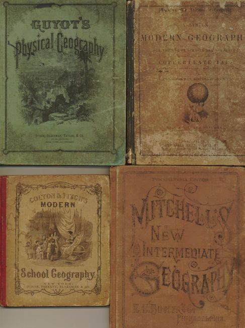
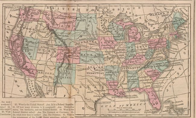
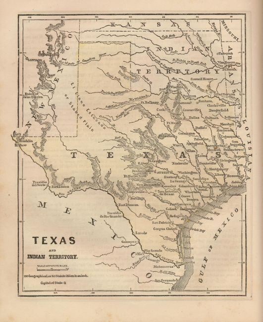
1) New York, Ivison, Phinney, Blakeman & Co., 1866, maps by G.W. Colton, 134 pp, (8.2 x 9.5"), hand-colored. Includes double page world, large North America, the United States and a fine "Texas and Indian Territory." Many other maps in text. Pictorial paper covers, 1/2 leather, large 8vo, 134pp, numerous maps. Contents tight, covers with some rubbing to spine and light stains on cover. (B+)
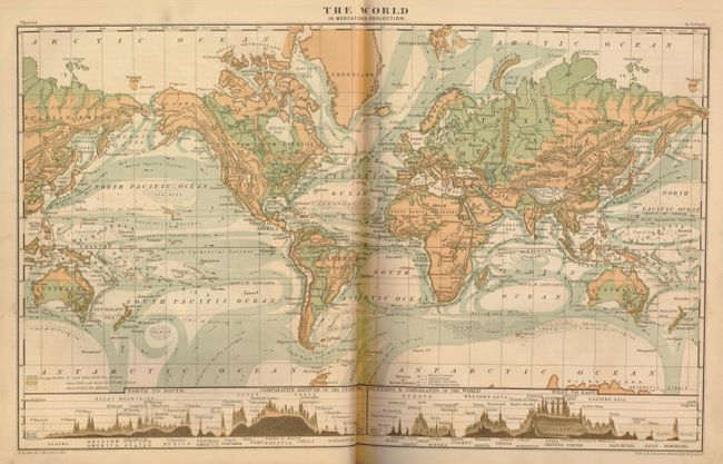
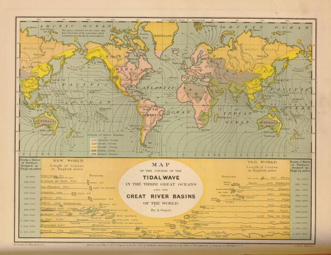
2) New York, Ivison, Blakeman, Taylor, and Company, 1873, 124 pp, (10.3 x 12.8"), printed color. Filled with thematic amps, graphics, and more. Pictorial paper covers, 1/2 leather, 124pp. Very nicely colored maps, double page are tipped in. Spine with 1" missing section at center, covers rubbed and soiled. Contents tight and pages mostly clean with even ivory toning, a few with short edge tears. (A)
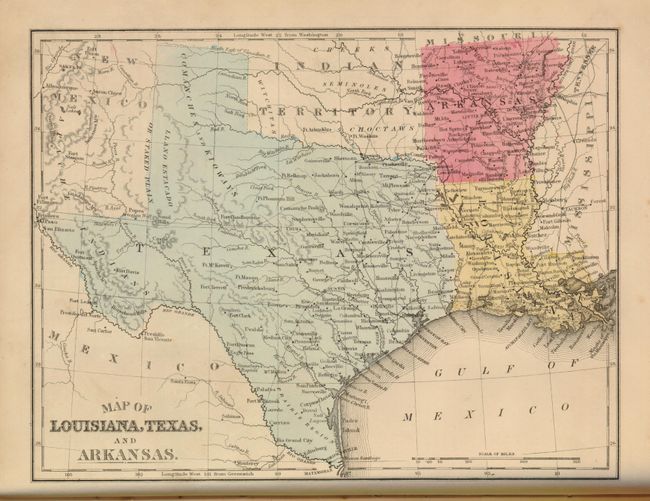
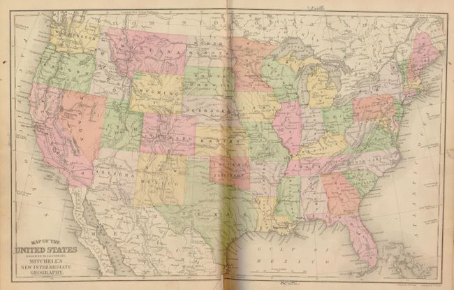
3) Philadelphia, E.H. Butler & Co., 1874, 114 pp, (10 x 12.3"), hand-colored. Numerous full page maps each with one or more states. The "Map of Louisiana, Texas and Arkansas" includes Indian Territory. Double page map of the United States has short split at lower centerfold. Covers worn, rubbed and bumped, spine chipped at top and bottom. Contents tight except first and last end papers, front cover starting. (C+)
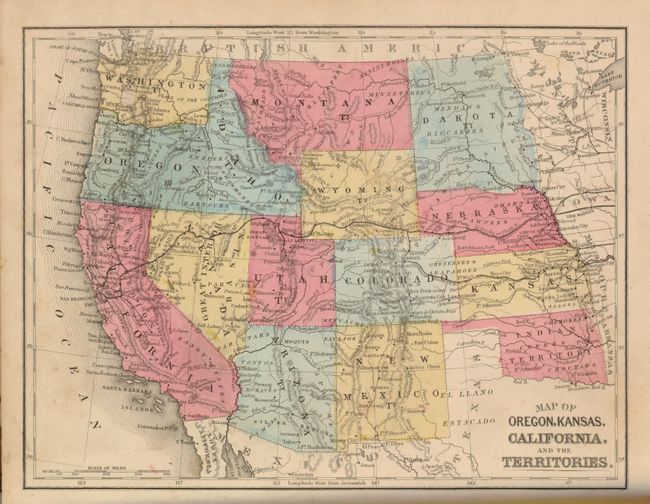
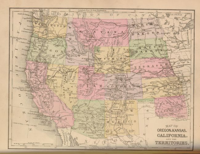
4) Philadelphia, E.H. Butler & Co., 1890, 1128 pp, (10 x 12.5"), hand-colored. These maps are late examples of hand coloring, done in a very fine hand with lovely color and a wider pallet than we're accustomed to seeing in a school geography. Basically the same maps as the 1874 geography above including Texas. Includes a very nice map of Canada. Three pages are torn with loss, not affecting maps except for Great Britain of which most is missing. Covers rubbed and a little faded. Contents tight with the occasional foxing mark to some pages. ( C )
References:
Condition:
See individual descriptions.