Subject: Madagascar
Period: 1690-1764 (published)
Publication:
Color:
This lot is composed of three copper engraved charts depicting the island of Madagascar.
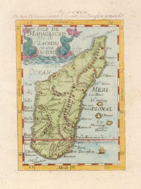
1) A. Mallet, c. 1690, from the German edition of Mallet's "Description of the World", Beschreibung des ganzen welt-kreisses…, (4 x 5.5"), later color. Two sea monsters at each side frame the title cartouche. German title above neat line "Die Insel Madagascar Sonst S. Lorentz oder Dauphin genanndt." Fine (A+).
2) Pierre vander Aa, Leiden, c. 1715, (14 x 11") b/w. Map includes part of the coastline of Mozambique. This handsome chart has many figures in the cartouche, two elaborate compass roses and rhumblines. Slight toning in map with a little more in the very wide margins. (B+)
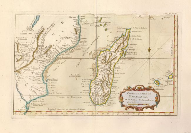
3) J.N. Bellin, Paris, c. 1764, (14 x 8.5"). Showing more of the continent than the vander Aa map above, this chart extends to Lac de Maravi west of a chain of mountains labeled "Lupata." Nicely colored and embellished with decorative rococo-style title cartouche, fleur-de-lis and rhumblines. Very wide margins and recent color (A).
References:
Condition:
See individual descriptions.