Subject: India
Period: 1920 (circa)
Publication:
Color: Printed Color
Size:
17 x 29.5 inches
43.2 x 74.9 cm
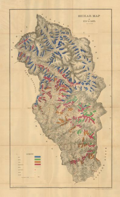
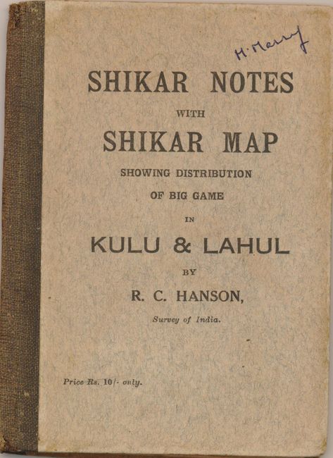
This pocket map was produced for the colonial "big game hunter" by R.C. Hanson. The map uses color coding to identify the range of the ibex, baral, tahr, brown bear, gural, black bear, sarao and kakar in these northern districts of India. Very fine detail of the region includes extensive topography on a scale of 4 miles per inch. Legend also identifies roads and stages. There are a few advertisements on the otherwise blank verso. Adverts include: Van Ingen & Van Ingen "Artists in Taxidermy;" Lyon & Lyon "High Velocity, Flat Trajectory Magazine Rifles;" The Kashmir Motor Car Service, Rawalpindi; The Cawnpore Cotton Mills Co, "Tents for Shikaris;" and The North West Tannery Co. "Saddlery of every description," Cawnpore. Shikar is derived from Sanskrit meaning "hunter" or "guide." The map folds into boards (4.7 x 6.5") titled, "Shikar Notes with Shikar Map Showing Distribution of Big Game in Kulu & Lahul by R.C. Hanson, Survey of India." On the inside pastedown, "Shikar Notes" help the would-be hunter with Routes, Dak Bungalows, Rest Houses, Game, Licenses, Seasons for Sport and Shikaries. The map was used by permission of Col. E.A. Tandy, Surveyor General of India. A most unusual thematic map.
References:
Condition: B+
Map has overall ivory toning to paper, with strong color and impression and full margins. Several small fold intersection splits. Covers are very good less a little light foxing or soiling.