Catalog Archive
Auction 128, Lot 783

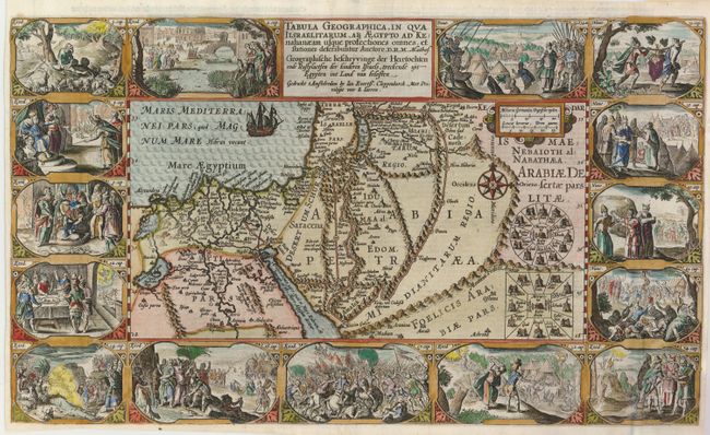
"Tabula Geographica, in Qua Iisraelitarum, AB AEgypto ad Kenahanaeam usque profectiones omnes, et stationes deseribuntur Auctore, D.R.M. Mathes…", Plancius/Cloppenburg
Subject: Holy Land

Period: 1625 (circa)

Publication:

Color: Hand Color

Size:
19.5 x 11.5 inches
49.5 x 29.2 cm
Download High Resolution Image
(or just click on image to launch the Zoom viewer)

Superb Bible map of the region surrounding the Dead Sea through the Nile Delta depicts the wanderings of the Children of Israel. Beautifully engraved panels at the top and bottom include vignettes of important events of Exodus, Deuteronomy and Numbers. This is the second state with improvements by D.R.M. Mathes, published by Cloppenberg. Dutch text on verso.

References: cf Laor #566; Poortman & Augusteijn #76.

Condition: B+

There are some expert repairs in the margins and on the folds including filling of a small hole in the title with skillful facsimile of part of the 'AB.'

Estimate: $1,100 - $1,500

Sold for: $800

Closed on 5/20/2009

Archived