Subject: Middle East
Period: 1540 (circa)
Publication: Geographia
Color: Black & White
Size:
13.6 x 10 inches
34.5 x 25.4 cm
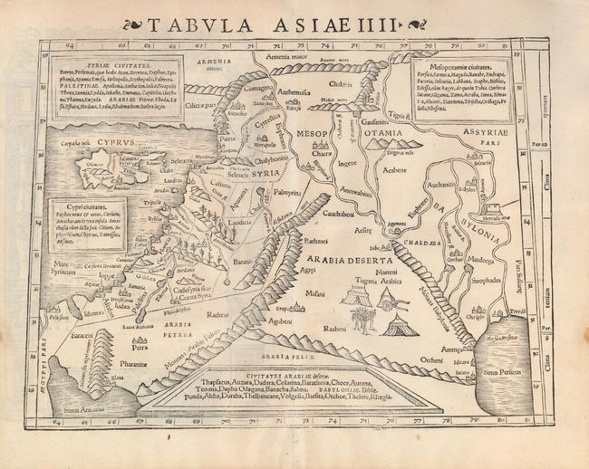
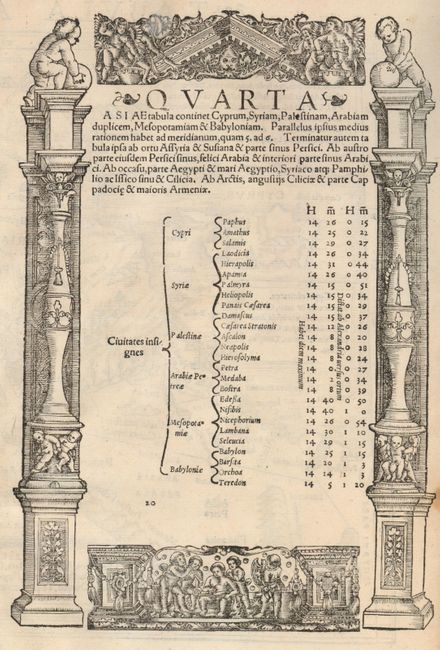
Woodblock Ptolemaic map of the Middle East from present-day Iraq and the Tigris and Euphrates Rivers westward to the Mediterranean Sea and the island of Cyprus. A Bedouin encampment is shown in the interior of Arabia Deserta. The shoreline of the Holy Land runs from Ptolemais (Acco) as far as Ascalon. There is a nonexistent bay north of Acco and also north of Jaffa. There are four text boxes describing Syria, Mesopotamia, Cyprus and Arabia. Architectural illustrations surround Latin text on verso.
References:
Condition: A
A very nice example with dark impression and wide, original margins. A little weakness along centerfold with expert tissue support on verso.