Subject: North Pole
Period: 1641 (circa)
Publication:
Color: Hand Color
Size:
20.8 x 16 inches
52.8 x 40.6 cm
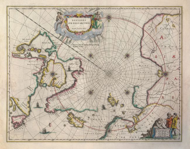
This is an early example of one of the important prototype maps of the Arctic. It incorporates new information from the explorations of Capt. Thomas James with the bay named for him labeled here James his Bay. The Arctic coast of Russia provides information from Willem Barentsz' voyage and Spitsbergen is shown according to the Danish expedition of James Hall. Rhumb lines radiate from the North Pole and a large title cartouche, with two figures and numerous wind heads, conveniently hides the northwest coast of America. The map is further decorated with several compass roses, ships and an additional cartouche that features men in parkas, a polar bear and foxes. This state was issued prior to the dedication being added by Johannes Blaeu. Dutch text on verso.
References: Burden #252; Goss (Blaeu) #2.
Condition: A
Early impression with some printer's ink residue in the plate and attractive original coloring.