Subject: World, Polar
Period: 1812 (dated)
Publication: Pinkerton's Modern Atlas
Color: Hand Color
Size:
19.8 x 19.8 inches
50.3 x 50.3 cm
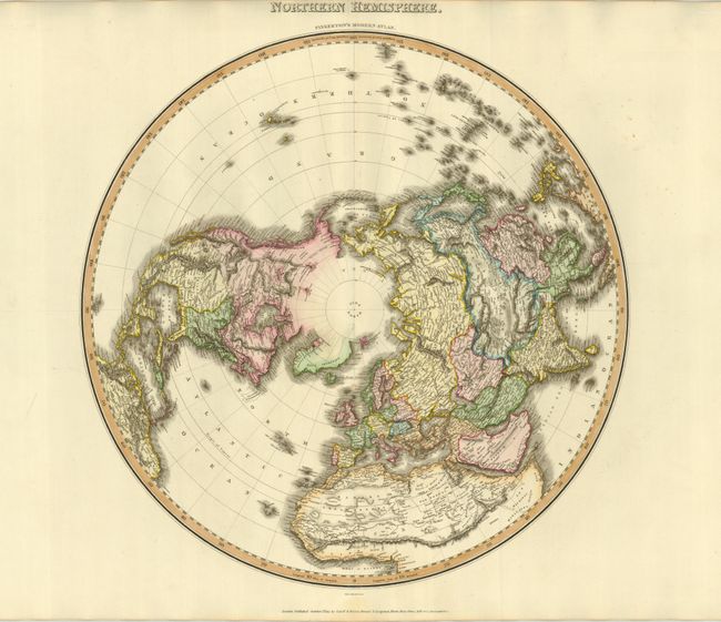
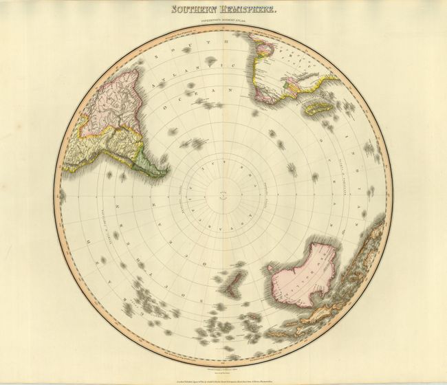
Two spectacular Scottish-produced maps from this uncommon publisher. The northern hemispheric map is centered on the North Pole and shows the latest discoveries in the Arctic. Several partially drawn coastal details with notations: "Coast discovered by the Hunters of Merch Linkhov", "the Sea Seen by Mr. Mackenzie in 1789", and "the Sea Seen by Mr. Hearne in 1771." The northern coastlines of North America and Greenland are left open-ended. Terrific detail within the continents with hundreds of place names and much information on watershed and topography. The map extends south to the Equator. The Southern hemisphere map shows all of New Zealand, Australia (New Holland), Papua New Guinea, and Madagascar. It extends north to the Equator, showing the Amazon River in South America and above the Congo region in Africa. The Antarctic region is completely blank with the Lord Aucklands Group noted as the furthest south islands. A great pair of matching copper engraved maps in remarkable condition.
References:
Condition: A+
Beautiful impression and coloring with huge margins.