Subject: Baltic
Period: 1705 (dated)
Publication:
Color: Hand Color
Size:
27.8 x 17.5 inches
70.6 x 44.5 cm
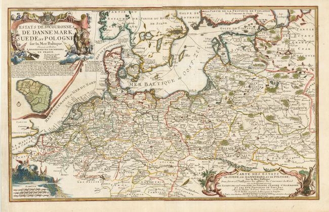
De Fer's two-sheet map of northern Europe. The map covers from Belgium through the Baltic states and over to Smolensk and Braclaw. Major trade routes, both on sea and land, are traced throughout the map. Herman van Loon engraved this beautiful map and richly embellished it with three cartouches. The primary title cartouche fills the left corner with scenes of war and victory, and below that is an inset map of Hven Island, the location of Tycho Brahe's observatory. In the opposite corner is a secondary title cartouche (Carte des Estats de Suede, de Dannemarq, et de Pologne; sur la Mer Baltique…) and the scale of miles cartouche is festooned with wind heads blowing strong, wintry winds. The coordinates for major cities are noted within the borders.
References:
Condition: A+
The binding trim at lower left has been professionally extended to accommodate framing