Catalog Archive
Auction 128, Lot 53

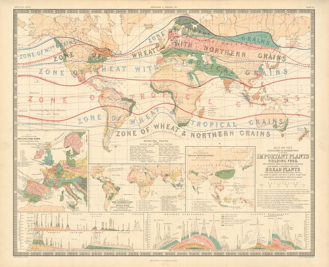
"Map of the Geographical Distribution of the Most Important Plants Yielding Food, Including the Cultivated Grains and Other Cultivated and Wild Bread Plants…", Johnston, W. & A.K.

Subject: World

Period: 1854 (dated)

Publication: Physical Atlas

Color: Printed Color

Size:
24.3 x 20 inches
61.7 x 50.8 cm
Download High Resolution Image
(or just click on image to launch the Zoom viewer)

This large map is a superb example of thematic mapping with various colors and diagrams used to illustrate agriculture throughout the world. Through color, the map illustrates the regions where primary grains are produced. Several smaller inset maps show the distribution of spices, fruit, and other principal food plants. This handsome chart is from the English version of Heinrich Berghaus' Physikalischer Atlas, which was the first truly comprehensive thematic atlas. It is a very early example of printed color, the development of which made a huge impact on cartography in general and specifically the graphic portrayal of geographical data on thematic maps.

References: Phillips (A) #225; Robinson, pp. 64-67.

Condition: A+

Estimate: $200 - $250

Sold for: $100

Closed on 5/20/2009

Archived