Subject: Cuba, Havana
Period: 1740 (circa)
Publication:
Color: Hand Color
Size:
21.3 x 17 inches
54.1 x 43.2 cm
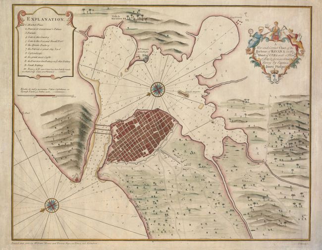
This rare map is one of the earliest maps of Havana published in England. It was based on the survey of Captain James Phelps and engraved by James Mynde. The detailed plan shows the harbor, fortified city and surrounding countryside. A key locates Morro Castle, the Custom House, the Governor's Palace, factories, and batteries. Two large compass roses orient the chart with north in the lower left corner of the map. This map has been variously dated between 1720 and 1760; it is likely closer to 1740 when the British interest in Cuba and Havana increased during the War of Jenkin's Ear. This map has not appeared in major dealer's catalogs for the past 25 years.
References: Cueto #161.
Condition: B+
The map appears to have been originally mounted on linen, which has now been removed. There are several small repairs on the verso, mostly in the blank margins. There is some minor surface soil in the map.