Catalog Archive
Auction 128, Lot 409

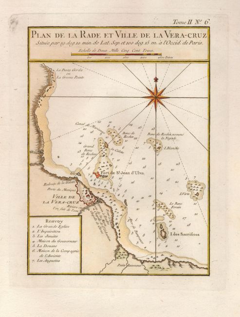
"Plan de la Rade et Ville de la Vera-Cruz", Bellin, Jacques Nicolas
Subject: Mexico

Period: 1764 (circa)

Publication: Le Petit Atlas Maritime

Color: Hand Color

Size:
7 x 8.5 inches
17.8 x 21.6 cm
Download High Resolution Image
(or just click on image to launch the Zoom viewer)

This attractive copper engraved chart details the fortified city of Vera Cruz and surroundings including the Fort de St. Jean d'Ulua. Outside of the fortified walls are the Redoute de al Galette, Chapelle de St. Sebastien, and the Chapelle de Christ. Seven important features are named and keyed to the map. Soundings and sailing hazards are noted in the bay . Southeast of Veracruz is the Petits Ruisseaux. Large compass rose with rhumblines. Distance scale is incorporated into title block above the map.

References:

Condition: A+

Dark impression on a full sheet with wide margins including the right deckle-edged margin.

Estimate: $100 - $140

Sold for: $75

Closed on 5/20/2009

Archived