Subject: Vermont
Period: 1876 (published)
Publication: Illustrated topographical and historical atlas of the State of Vermont
Color: Hand Color
Size:
14 x 11 inches
35.6 x 27.9 cm
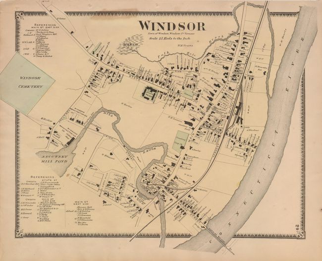
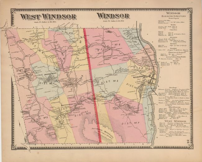
Pair of strongly engraved maps describe the counties and town of Windsor. The town plan is on the west bank of the Connecticut River. Individual buildings are shown with land owner's name adjacent. The route of the Vermont Central Rail Road includes the spur into town and the large depot building. The second map delineates the counties of West Windsor and Windsor, bounded on the east by the Connecticut River. The map has amazing detail, identifying individual buildings and land owners. It shows roads and lanes, post offices, and divides the counties into Districts with line and hand coloring. Locates Sheddsville, Windsor, Brownsville, Ascutney Mountain, and more.
References:
Condition: B+
Both will original color and dark impression. Binding holes in upper blank margin, stain at upper border on the latter.