Catalog Archive
Auction 128, Lot 381

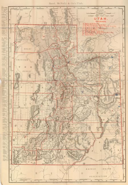
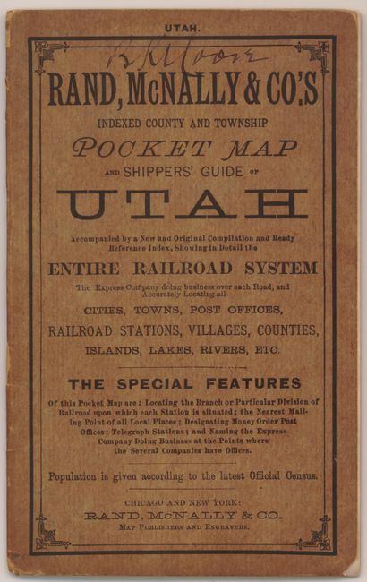
"Rand, McNally & Co.'s Indexed County and Township Pocket Map of Utah...Showing in Detail the Entire Railroad System…", Rand McNally & Co.

Subject: Utah

Period: 1899 (dated)

Publication:

Color: Printed Color

Size:
12.5 x 19 inches
31.8 x 48.3 cm
Download High Resolution Image
(or just click on image to launch the Zoom viewer)

This detailed pocket map "Rand McNally & Co.'s Utah" has each county individually colored in outline and locates "Cities, Towns, Post Offices, Railroad Stations, Villages, Counties, Islands, Lakes, Rivers, etc." Key at left uses red overprinting to identify ten railroads. City index at left keys all towns and villages to map. Blank verso. The 18 page guide book also has several pages of early advertisements. Original brown paper covers with huge list of Rand McNally "Indexed Pocket Maps." This pocket map originally sold for $.25.

References:

Condition: B+

The map has a few rough areas in margins, one clean fold split at bottom, and a few blue pencil marks on map and is detached from the covers. The covers have an ink name across the top.

Estimate: $80 - $100

Sold for: $60

Closed on 5/20/2009

Archived