Subject: New York City
Period: 1838-1850 (published)
Publication:
Color: Hand Color
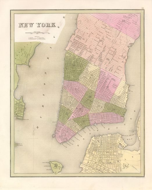
The first city plan is from Bradford's large scale and less-common An Illustrated Atlas, 1838, (11.5 x 14"). It extends to include a small portion of Fifty-Third Street, part of Hoboken and Brooklyn. Shows all of Governors Island and most of Ellis Island. All wards are numbered and all streets are named. Locates City Hall, Merchant's Exchange, NY Hospital, Columbia College, New York University, parks, and more. Engraved by G.W. Boynton. A bright example with no flaws save a little smudge or soiling near title, still fine. (A+)
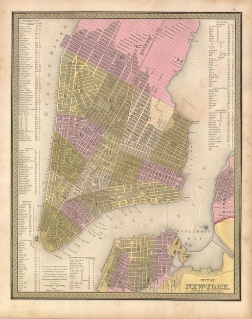
The second plan is from S.A. Mitchell's New Universal Atlas, Philadelphia, c. 1850, (12.3 x 15.5"). This plan covers Manhattan as well as parts of Williamsburg and Brooklyn. Manhattan is shown in great detail as far north as 37th Street. Locates ferry routes, docks, and names all streets. Tables at sides index more than 200 important public buildings, hotels and churches. Decorative borders surround this attractive plan. Original hand coloring, good impression and full margins. Some scattered foxing mostly in margins and in the East River. (B)
References:
Condition:
See individual descriptions.