Subject: Minnesota
Period: 1857 (dated)
Publication:
Color: Hand Color
Size:
5 x 7.5 inches
12.7 x 19.1 cm
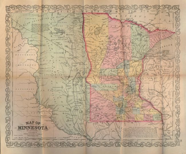
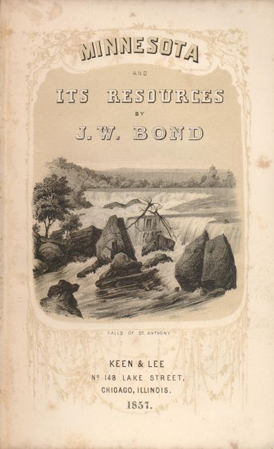
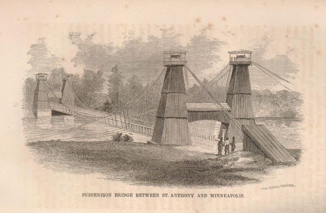
Very interesting book describing the territory's history, geography, climate, agriculture and resources. A fine lithographed view, the Falls of St. Anthony is on the title page. A very nice foldout Map of Minnesota Territory by J.H. Young & Charles Desilver is bound into the back of the book (16 x 13"). This map shows the territory roughly with today's borders. Extending to the Missouri River is the unorganized region "Proposed Dakota Territory" with interesting place names, references to buffalo, and more. Information on the Sioux treaties of 1851 is contained in a note at bottom. The location of several forts on the Missouri River are shown including Fort Mandan where Lewis and Clark are noted to have wintered in 1804-05. Minnesota Territory was created in 1849 and granted statehood in 1858. The book contains several copper engraved views, including Suspension Bridge Between St. Anthony and Minneapolis, Minnehaha Falls, and St. Paul as it is in 1856. There are three pages of advertisements in the front. Hardbound in original embossed brown cloth with decorative title on spine, 412pp including a 77 page appendix and supplement. Published by Keen & Lee, Chicago, Ill.
References:
Condition: B+
The folding map has fine original hand coloring, dark impression on sheet with full margins. Slightly mis-folded and one small split at fold intersection. Spine ends chipped. Contents tight.