Subject: Hawaii
Period: 1784 (published)
Publication:
Color: Black & White
Size:
18.3 x 11 inches
46.5 x 27.9 cm
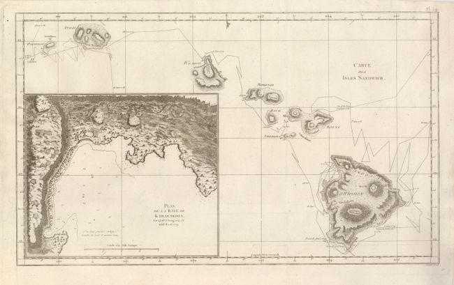
This important map of the newly discovered Hawaiian Islands is from the first French edition of Cook's voyages. It appeared the same year as the original English edition. The attractive copper engraved chart shows the track of Cook's first encounter with the islands in early 1778, as well as his second exploration of the islands in late 1778 and early 1779. There is an inset of Kealakekua Bay (Plan de la Baye de Karakakooa) where Cook met his death at the hands of the natives. Engraved by Benard from Henry Roberts' chart.
References:
Condition: A+
Issued folded, now flattened, with the binding trim at lower left professionally replaced.