Subject: Colorado
Period: 1863 (dated)
Publication: HR Ex. Doc No. 1, 38th Cong., 1st Sess.
Color: Black & White
Size:
22 x 16.3 inches
55.9 x 41.4 cm
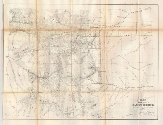
This is the third official map of Colorado that was published to accompany the 1863 report of the Surveyor General, John Pierce. It is an early, uncommon map of Colorado, with no counties delineated, although the first counties were established in 1861. Very little settlement is shown in the Rockies, rather, named rivers, creeks and mountain ranges. The few communities located include Fair Play, Jefferson, Hamilton, Montgomery, Laurette, Grand City, and a few more. Gold Dirt is shown north of Nevada City, the first indication of gold on any state survey map. Along the front range, Denver and the smaller communities of Golden Gate, Golden City, Boulder City, Colorado City, Bradford, Canon City and a few others are located. To the east the lands of the Cheyennes and Arapahoes are noted. The Base Line is prominently delineated with surveyed areas limited to a narrow band in the center of the map that includes Denver. The route of General Winkoop in his 1863 pursuit of the Ute Indians is noted in the western part of the territory. Mountain elevation is delineated through hachure. Signed in the plate by John Pierce.
References:
Condition: B
Map is fine less an area of toning or staining along one fold near top. Fine impression, bright and sound paper with full margins.