Subject: Western United States
Period: 1825-27 (published)
Publication: Atlas Universel
Color: Hand Color
Size:
22 x 18 inches
55.9 x 45.7 cm
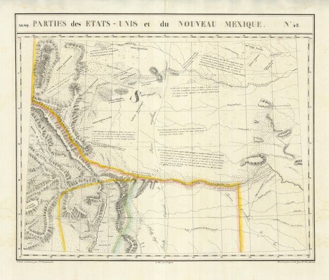
This uncommon map is centered on western Colorado and includes parts of Wyoming, Nebraska, Kansas, Oklahoma, Texas, and New Mexico including Santa Fe. The map was published only a few years after Long's seminal map of the region and it incorporates a great deal of information from this important expedition. The source of the Rio Grande in the mountains of Colorado is particularly well established, and just a few miles north a note mentions Pike's apocryphal sighting of the Yellowstone River. This alludes to the long-held hypothesis of a common continental river source, a theory that great influenced cartographers during this period. The map locates a number of regional Indian tribes and their populations, as well as several pueblo villages north of Santa Fe.
The Atlas Universel was the first atlas to present all the maps on the same scale (1: 1,641,836) about one inch to 26 miles, with each map covering an area of approximately 20 degrees longitude (from Paris) and 6 degrees of latitude. It was also considered to be the first lithographic atlas ever published. The maps were meant to be joined together to form a huge globe measuring 7.775 meters in diameter. Only one edition of the atlas was published in 1825-27 and the subscription list shows that just 810 copies were sold; thus the maps are very scarce on the market today.
References: Wheat [TMW] #378.
Condition: B+
There is some faint scattered foxing, else very good with original outline color.